DS09
Site code DS09
Location Cervantes
Region Galicia
Country Spain
Local name Moreira
Partner CIF
Site characteristics
Orientation: NE, Slope:28.0°, Soil :REGOSOLS, Bedrock : acid to intermediate plutonic rocks
PH :4.4,
Hydrology
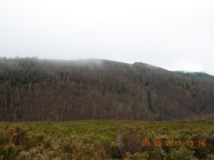
High slope in the mountain chain Serra de Ancares, the eastern limit of Galicia, faced to the river Navia basin, with the stream Rego do Cespedosa flowing across the plot
Short History of the site
 copyrigth IEFC network
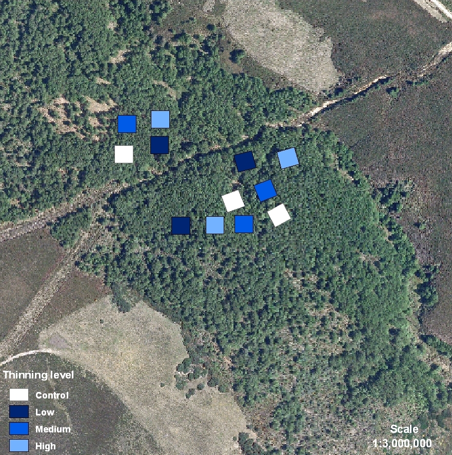
In the municipality, pastures (5% usable area) and forests (87% usable area) provide almost the total incomes for the sparse inhabitants. The traditional practice of raising cattle, mainly with bovine autochthonous races like Rubia galega, supplies milk and beef for their own consumption. Forest afforestations with Scots pine are placed where grasslands cannot be established. Oaks, birches, beeches and hazels make up the natural woodlands in the valleys and in the stream banks. The mountain chain Serra de Ancares is a protected area for conservation included in Nature 2000 net and a National Reserve for Game Hunting. Roe deer, wild boar and ibex are the most valuable species. DS09 is placed on a private land. The land is owned and managed by the Neighborhood Forest of Xunquiñas, typical of Galician culture. All the forest area belongs to a territorial demarcation, parroquia, which joins all the neighborhood members. Each citizen owns a percentage of the whole indivisible forest area and the management must be agreed with all the members of the community by a common consent. In Galicia, this way of forest property is called Neighborhood Forest in Common Hand. The stand shows an even-aged birch canopy from natural regeneration covering understory mainly with grasses and some shrubs (blackberry and heaths). Thinning treatments were applied in 2001. Tree stand characteristics before treatments were: Age (28 years) Mean DBH (8.4 cm), Dominant Height (11.1 m), Density (3477 tree/ha).
En esta localidad, la población vive muy dispersa y su renta procede casi en su totalidad de los pastos y del bosque que ocupan respectivamente el 5% y el 87% de la superficie útil. La economía de autoconsumo está apoyada en el pastoreo con ganado, principalmente con vacas de la raza autóctona Rubia Galega que suministra leche y carne. Las repoblaciones de pino silvestre ocupan áreas de monte, donde los pastos no prosperan. Robles, abedules, hayas y avellanos conforman el bosque caducifolio en las vaguadas y en las riberas de los regatos. La Serra de Ancares es un área protegida por la red Natura 2000 y Reserva Nacional de Caza. Corzos, jabalíes y rebecos constituyen las especies cazables de mayor interés. DS09 está situado en terreno de propiedad privada. La tierra pertenece y está manejada por la Comunidad de Monte Vecinal en Mano Común de Xunquiñas, régimen típico de Galicia. El área forestal pertenece a una demarcación territorial, la parroquia, que aglutina a todos los vecinos. Cada vecino posee un porcentaje indivisible del monte y las decisiones se toman de común acuerdo entre todos los miembros. El área experimental está ocupada por una masa regular de abedul de regeneración natural que cubre un sotobosque homogéneo donde predominan las herbáceas y arbustos como los brezos y los arándanos. Los tratamientos de claras se hicieron en 2001. Esta masa regular presentaba inicialmente las siguientes características: Edad (28 a